Recomienda este artículo a tus amigos:
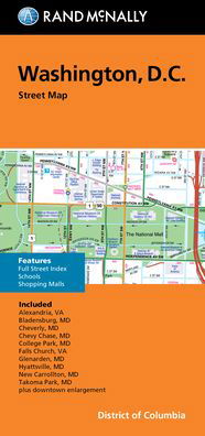
Rand McNally Folded Map: Washington, D.C. Street Map


Rand McNally Folded Map: Washington, D.C. Street Map
Rand McNally
Rand McNally's folded map for Washington, D. C. is a must-have for anyone traveling in and around this part of District of Columbia, offering unbeatable accuracy and reliability at a great price. Our trusted cartography shows all Interstate, U. S., state, and county highways, along with clearly indicated parks, points of interest, airports, county boundaries, and streets. The easy-to-use legend and detailed index make for quick and easy location of destinations. You'll see why Rand McNally folded maps have been the trusted standard for years. -Regularly updated. -Full-color maps. -Clearly labeled Interstate, U. S., state, and county highways. -Indications of parks, points of interest, airports, county boundaries, schools, shopping malls, downtown & vicinity maps. -Easy-to-use legend. -Detailed & full street index. -Convenient folded size. Coverage Area: Alexandria, Va Bladensburg, Md Cheverly, Md Chevy Chase, Md College Park, Md Falls Church, Va Glenarden, Md Hyattsville, Md New Carrollton, Md Takoma Park, Md plus downtown enlargement. Product Details: Measures 9.5 x 4 and folds out to 40 x 28.
| Medios de comunicación | Libros Map (Cartas terrestres o náuticas) |
| Publicado | 30 de septiembre de 2021 |
| ISBN13 | 9780528025358 |
| Editores | Rand McNally |
| Dimensiones | 102 × 226 × 15 mm · 113 g |
| Lengua | Inglés |
Mas por Rand McNally
Mostrar todo


Mere med samme udgiver


Ver todo de Rand McNally ( Ej. Paperback Book , Map , Book , Hardcover Book y Spiral Book )