Recomienda este artículo a tus amigos:
Delorme Atlas & Gazetteer Rand Mcnally


Delorme Atlas & Gazetteer
Rand Mcnally
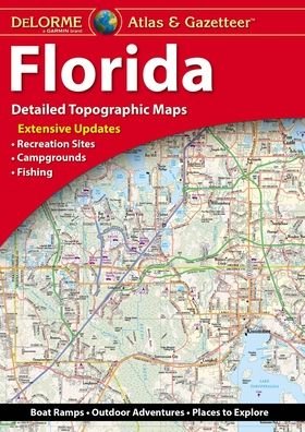
With an incredible wealth of detail, DeLorme's Atlas & Gazetteer is the perfect companion for exploring the Florida outdoors. Extensively indexed, full-color topographic maps provide information on everything from cities and towns to historic sites, scenic drives, trailheads, boat ramps and even prime fishing spots.
Conveniently bound in book form, the Atlas & Gazetteer is your most comprehensive guide to Florida's backcountry.
Full-color topographic maps provide information on everything from cities and towns to historic sites, scenic drives, recreation areas, trailheads, boat ramps and prime fishing spots
Extensively indexed
Handy latitude/longitude overlay grid for each map allows you to navigate with GPS
Inset maps provided for major cities as well as all state lands
Product Details: Florida State
Dimensions: 15.5" x 11"
AVAILABLE FOR ALL 50 STATES
| Medios de comunicación | Libros Paperback Book (Libro con tapa blanda y lomo encolado) |
| Publicado | 2 de septiembre de 2019 |
| ISBN13 | 9781946494337 |
| Editores | Delorme Mapping Company |
| Páginas | 160 |
| Dimensiones | 277 × 391 × 10 mm · 839 g |
| Lengua | Inglés |
Mas por Rand Mcnally
Mostrar todo


![Cover for Rand McNally · A Pocket Atlas of the [world] [cartographic Material]: Presented to the Patrons and Friends of the Chicago & North-Western Ry. Co. With the Compliments of the Passenger Department (Paperback Book) (2021)](https://imusic.b-cdn.net/images/item/original/417/9781015179417.jpg?rand-mcnally-2021-a-pocket-atlas-of-the-world-cartographic-material-presented-to-the-patrons-and-friends-of-the-chicago-north-western-ry-co-with-the-compliments-of-the-passenger-department-paperback-book&class=scaled&v=1649334010)


![Cover for Rand Mcnally · Rand Mcnally Providence Street Map (Paperback Book) [Map edition] (2020)](https://imusic.b-cdn.net/images/item/original/153/9780528008153.jpg?rand-mcnally-2020-rand-mcnally-providence-street-map-paperback-book&class=scaled&v=1512788431)
![Cover for Rand Mcnally · Rand Mcnally Folded Map: Fort Lauderdale Metro Street Map (Paperback Book) [Map edition] (2013)](https://imusic.b-cdn.net/images/item/original/996/9780528007996.jpg?rand-mcnally-2013-rand-mcnally-folded-map-fort-lauderdale-metro-street-map-paperback-book&class=scaled&v=1435855826)
Mere med samme udgiver
Más de esta serie
Ver todo de Rand Mcnally ( Ej. Paperback Book , Map , Book , Hardcover Book y Spiral Book )